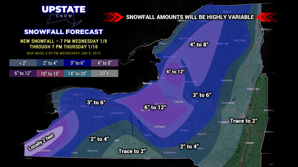
Good evening! Just a quick update tonight. Our lake effect storm continues. Bands of heavy snow will continue to impact portions of the upstate through Thursday afternoon before winding down late Thursday night. Additional HEAVY accumulations are expected on the Chautauqua Ridge where locally 2 feet of snow can be expected through tomorrow evening. Our map looks like gangbusters on here, but it cannot be emphasized enough… and those who have lived here all our lives know this… lake effect snows can be and are highly variable. Not everyone, for instance, in the 6-12 areas are actually going to see that, but that’s where we believe the highest potential exists for these amounts… and some spots may pick up quite a bit more. Some of us will be big winners, and some of us will be left with … not much. That’s the nature of the lake effect beast.
As strong high pressure starts to build east over the area late Thursday night into Friday, the moisture supply will be cut off and the snows will come to an end.
It’s looking more and more likely that the system this weekend is a complete miss, moving to our south; however, a cold air pattern looks to remain in place into early next week with occasional snow showers possible Sunday into Monday.
Have a good one, and BE SAFE if you’re out traveling tonight…


