Hi everyone…
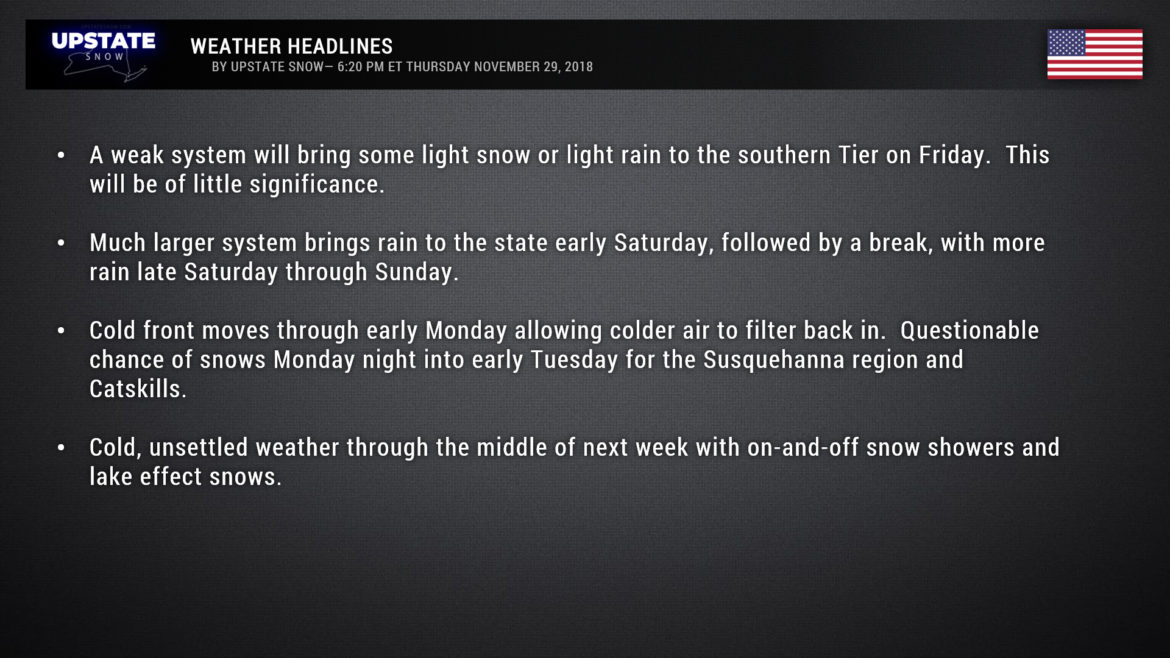
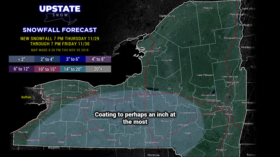
A weak little system will scoot off to our south tomorrow. This may bring some light snow to the Southern Tier… or light rain… or a little of both. Either way, it will be of no significance whatsoever… maaaayyyyybe an inch of snow if you’re a lucky one.

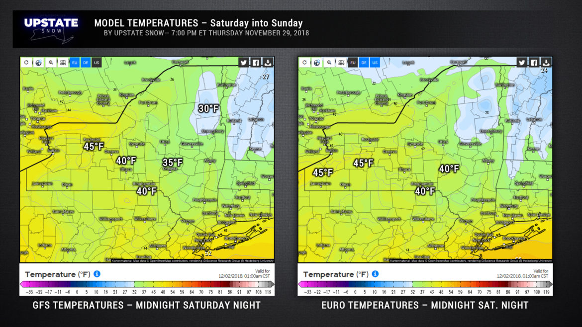
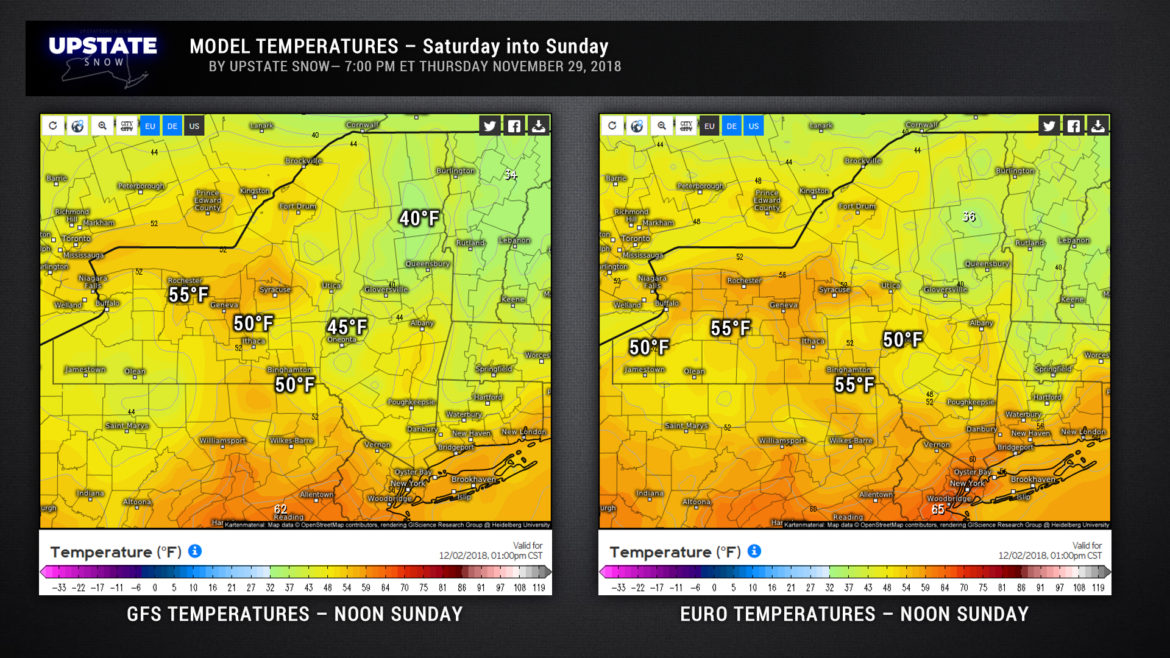
The weekend…. No matter how we spin this, the news is the same, and it’s not great. So we’ll rip off the Band-Aid in one swipe right here: It’s going to be warm and rainy late Saturday into Sunday. A storm system will track from the southern Plains through the Great Lakes and up the St. Lawrence over the weekend. As this takes shape, a really strong, unseasonably warm and moist southerly flow will blast into the upstate. Rain will break out at some point Saturday afternoon or evening. The devil is in the details here… the GFS wants to paint rain across our area much earlier Saturday afternoon… but model sounding show a pretty dry layer off the deck and the GFS tends to push rain through dry layers a bit sooner than it should. But whatever, it’s rain… and it’s going to happen. Saturday night will be rainy… with temperatures WARMING through the night. Showers taper off Sunday morning as we are firmly planted in the warm sector of this system. Some breaks of sunshine are possible Sunday afternoon which would mean temps go even higher than models suggest.
Models indicate generally between a half inch and one inch of rain to come from this system. This, along with the jump in temperatures, will lead to snow melt, and may cause some minor flooding problems in some areas.
The next round of rain moves in Sunday night ahead of the cold front associated with our storm system. This front should sling across the state sometime late Sunday night or Monday… again the timing is questionable, but it doesn’t really matter in the grand scheme of things: Monday’s highs come early in the day to midday from west to east, with temps falling. Look for leftover rain showers to mix with and change to snow showers from west to east.
Models waffle on whether or not low pressure spawns on that front and moves just south of here later Monday or Monday night. We could … COULD … get an area of rain-to-wet snow quickly pushing through the area late Monday / Monday night… and the potential is just as equal that we get a whole lot of nothing. Either way, for the rest of the mid-week next week look for temps drop back to reality for early December, with occasional snow showers and lake effect on a persistent west to northwest wind flow.
Ok folks, that’s it for tonight! Have a good one!


