Good evening…
Snow showers are dropping southeast across Lake Ontario and will impact portions of Oswego, Jefferson, Lewis, Oneida, and Herkimer counties this evening. A weak system will move across the state late tonight into Monday, but moisture is pretty scant… the main impact will be some snow showers and flurries tonight… and some snow or rain showers on Monday.

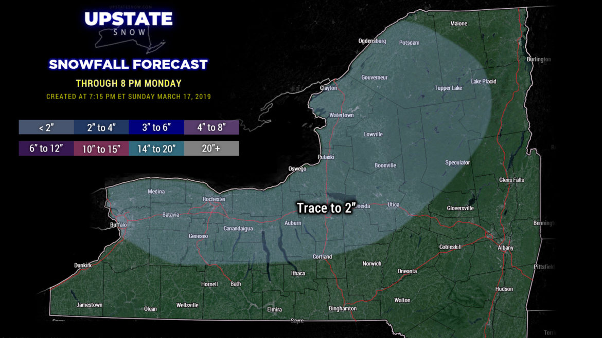
For our snow map tonight there’s a wide swath in the trace-2 color… not everyone in this area will get snow… and most places that DO get snow, it’s going to be an inch or less. One or two isolated spots may pick up a 2-inch or even a 3-inch amount, but that’ll be hard to come by.
Otherwise conditions become very quiet Monday night into Wednesday as high pressure builds into the Upstate. We’re going to have some cold air leftover to start, but it’s not going to stick around for very long, as by Wednesday much of the state warms to the 40s / around 50 (mid 30s to around 40 for the Adirondacks).
By Wednesday evening, the next weather system takes aim on the Upstate. Low pressure drops southeast out of Canada while another disturbance moves east through the Ohio valley. The question is whether or not these two phase — the Euro and GFS agree that they do — but even then the end result won’t be more than rain and snow showers Wednesday night into early Friday, with marginal accumulations over the Tug and in the Adirondacks. If that.
For some reason the FV3 wants to spin up a Nor’easter out of this… but keeps whatever forms farther to our east. The only ramification would be a reinforcing cold air mass going into Friday afternoon with scattered to numerous snow showers. This model has INSISTED on this setup for several runs now, but it is such an outlier … we’re just not sure we’re sold on that scenario. The most likely scenario is rain and/or snow showers, depending on elevation Wednesday night into early Friday. A cold front will push across the region and briefly return us to a chillier air mass and some snow showers east of Lake Ontario later on Friday.
Next weekend looks like we dry out with warming temps once again.
Thanks for viewing, and we’ll catch you tomorrow!


