
You know us. If there is ANY chance of cold and/or snow within one week from today, we are at least going to report on it. We won’t say definite. We won’t say several inches (because it probably won’t be), but just letting you all know fall is progressing as it should. The leaves are near or at peak now. Higher elevations are past past and the leaves are coming down. The valley areas should be glorious over this next week. And the weather that is coming, particularly at the end of this week, will advance the fall colors quickly. Take them in while you can.
We have three storms this week. The one giving you all rain today, this is what is left from Isaias. This will pull off the coast tonight and it should be quiet with a mix of sun and clouds to partly sunny skies for Columbus Day.

The second storm on Tuesday will have some warm push with it as some thunderstorms are now indicated particularly to the south of the Thruway. Once this storm passes by Tuesday Night, there will be a cooler shot of air behind it. We would call this blast of air for Wednesday through Friday more “near normal” with highs in the 50’s and lows in the 30’s and into the low 40’s.
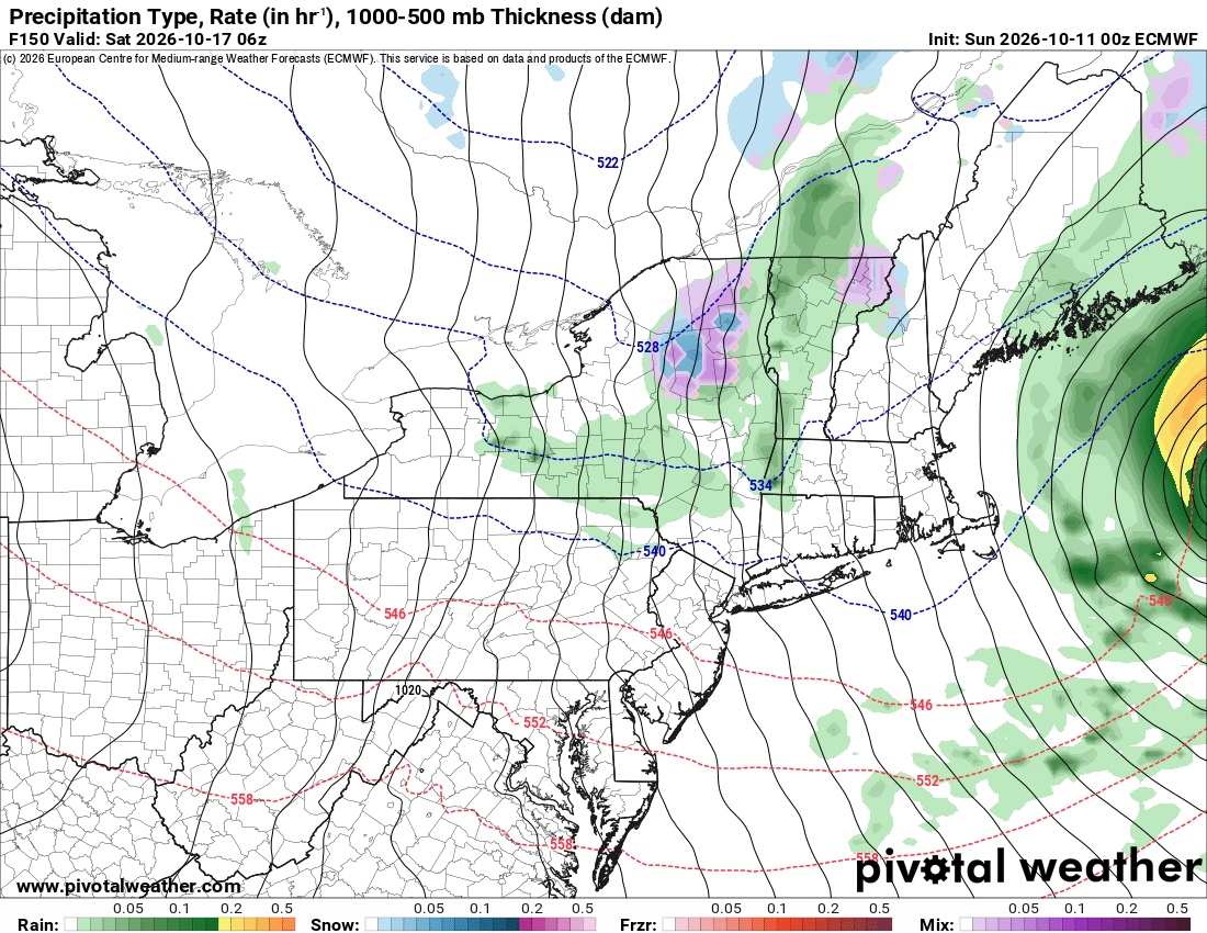
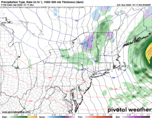
The third storm has my attention. This is Friday’s storm. This brings showers to the area followed by breezy conditions and much cooler air behind it. Check out what happens to the heights Friday Night and into Saturday Morning across Upstate NY. We go sub 540. And it gets cold enough to where the first higher elevation snows would get down to the town and village level in the Adirondacks and locations generally above 1000 to 1500 feet. In all likelihood it would just be enough to be the first “dusting” of the year for most in the Adirondacks. In the lower elevations, it should just remain warm enough by a few degrees. Remember when we talk about snowfall in the start and the end of the seasons: ELEVATION IS EVERYTHING!
First very early call on Friday Night/Saturday Morning snowfall: TRACE ONLY IN THE ADIRONDACKS ABOVE 1500 FEET. THIS FORECAST IS SUBJECT TO CHANGE.
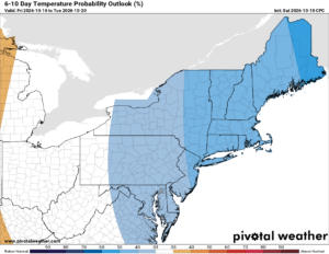
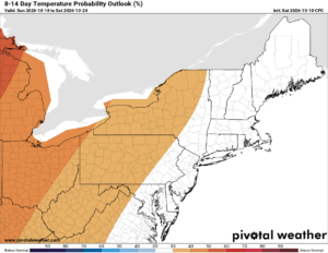
Through next weekend and into early the following week we would continue to run below normal. But as we head to the 8-14 day, that outlook starts to change. This is telling me that this mid October cold blast is probably one of the better ones we will have this month. It’s more November we start getting excited about these. We are getting closer.
Thank you Upstate Snow Nation for everything you have done to support us!
Zack and Rich Lupia
Upstate Snow
October 11, 2026
PLEASE THANK OUR SPONSORS FOR THE 2026-27 SEASON!
Business Sponsors
Enjem’s Flooring America
Ohio Ridge Riders
ILSNOW.COM
Personal Member
Charles A. Klesse Sr.