
The Morning Blog is brought to you by the T.C. Riders of Northern Oneida County, the southern gateway to the Tug Hill! With five main trails, 68 miles of responsibility, the club takes care of the Camden area, and the southwestern flank of the Hill. The club is active always on social media and in the community. For more information or to get involved CLICK HERE.
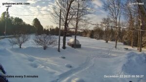
COLD BROOK

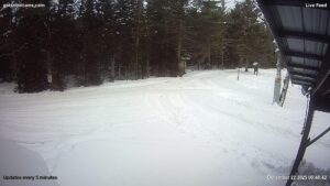
FORESTPORT
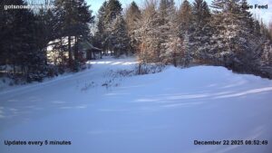
SAILSBURY
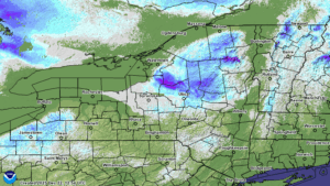
What happened this weekend? Well we took off for Lynchburg, VA for the weekend. We are just catching up this morning hence the later update. And it figures WE WAY underestimated the lake effect snow, particularly off of Lake Ontario. This should not be happening considering the temperatures are not crazy like they were before the thaw. We had figured 1-4 inches. Yeah. We had 10 and counting last evening from reliable observers just north of Utica. Oh my! A general 6-12 inch from Oswego through Northern Oneida, Southern Lewis and into Central Herkimer County. Sometimes you nail it. Other times YOU GET NAILED. But with this being MORE than we expect, and with snow cover being DOWN after THE THAW, we expect most of you all are HAPPY.
Where does this leave snowmobiling? In a much better place than it was Saturday. We had a full weekend of all hands on deck cleaning up the junk that fell all over our trails. We had the decent Sunday snows to replace some of what was lost. And with it being 3 days from Christmas, MANY ARE PROMISED THE FIRST WHITE CHRISTMAS SINCE 2018! What is next?
NEXT SYSTEM
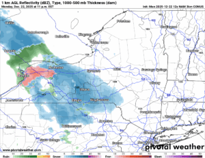
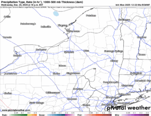
This storm starts off as snow overnight and into the morning hours. It’s all snow and at least a few inches overnight and into the morning Tuesday.
SOME MIXING
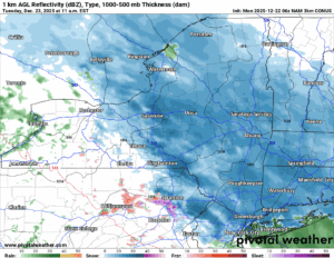
It is not showing up in the NAM 3K for temperatures but there should be in the lower elevations a mix with or a change to rain with temperatures climbing above freezing for a time. At or above 1000′, the temperatures should hold near freezing which should keep this mainly a snow event. I would expect a winter weather advisory to be issued for at least a few counties here.
TUESDAY NIGHT
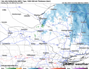
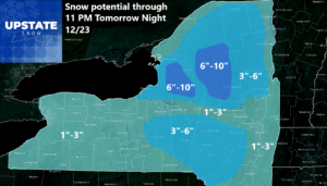
This system changes back to snow as it is exiting the Upstate of NY in the evening. The snow will linger mainly east of I-81 through midnight. Here is what the forecast accumulations look like for Tuesday with this system:
CHRISTMAS EVE WITH SANTA
Santa’s sleigh (or your sleds) will have joyful ride through Upstate NY on Christmas Night with a varying amount of clouds. We will call it partly to mostly cloudy. Temperatures should be about normal. Santa’s gifts will complete your tree!
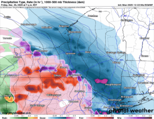
DAY AFTER CHRISTMAS
This system will not be like Tuesday’s system. This system is coming more from the south and will be trending farther north and west of Upstate NY. This means whatever snow we start with goes quickly to rain, and it stays rain. This may be true in the higher elevations as well. As I am looking at Friday and into Saturday, this storm is concerning me more. But the EURO the most reliable has suddenly gone colder and with more snow across Upstate NY while the GFS is of course, warmer with more rain. Since this storm will have more precipitation with it, this will need to be watched. Closely.
BOTTOM LINE
There WILL BE SOME RIDING FOR THE HOLIDAYS THIS YEAR! Will it be perfect? Nope. Will I be riding the sofa wishing I could ride the ground anywhere like in the last several years? Nope. It will be somewhere in between. Keep watching the weather changes daily. I will stay on top of it as best as I can.
NYSSA Public Trail Map
If you would like to advertise on the site, reach out anytime!
VENMO: @Zman291
CASH APP: #ZACKLUPIA
Zack and Rich Lupia
Upstate Snow
December 22, 2025
Please thank our advertisers on Upstate Snow!
Business Sponsorships
Ohio Ridge Riders
Enjem’s Flooring America
ilsnow.com
Saratoga Snowmobile Association
Southern Tug Hill Snow-Riders
Business Members
John Schoff Polaris Memorial Ride
Personal Members
James Andre
Eric Vilovchik
Charles A. Klesse Sr.


