
It’s on! Four snow events in the next week. The second one pictured is the Tuesday event, which will be significant. Each one will be different. This is a short summary update due to my time constraints. Snow map for the late Monday/Tuesday storm will be posted tomorrow morning.
#1 – This evening through tomorrow morning. I’m sticking with the 1-3 inch forecast from yesterday. 3″ is probably high side now and some may get just a trace. Still think most will get an inch or two so the forecast holds. Sunday is nowhere near as cold as recent days. Quiet first half of Monday

What I referred to as 1 1/2 yesterday looking more like the initial shot of snow ahead of storm #2. Monday night through Tuesday Upstate NY is under the gun. All that’s left now is how much and precip type.
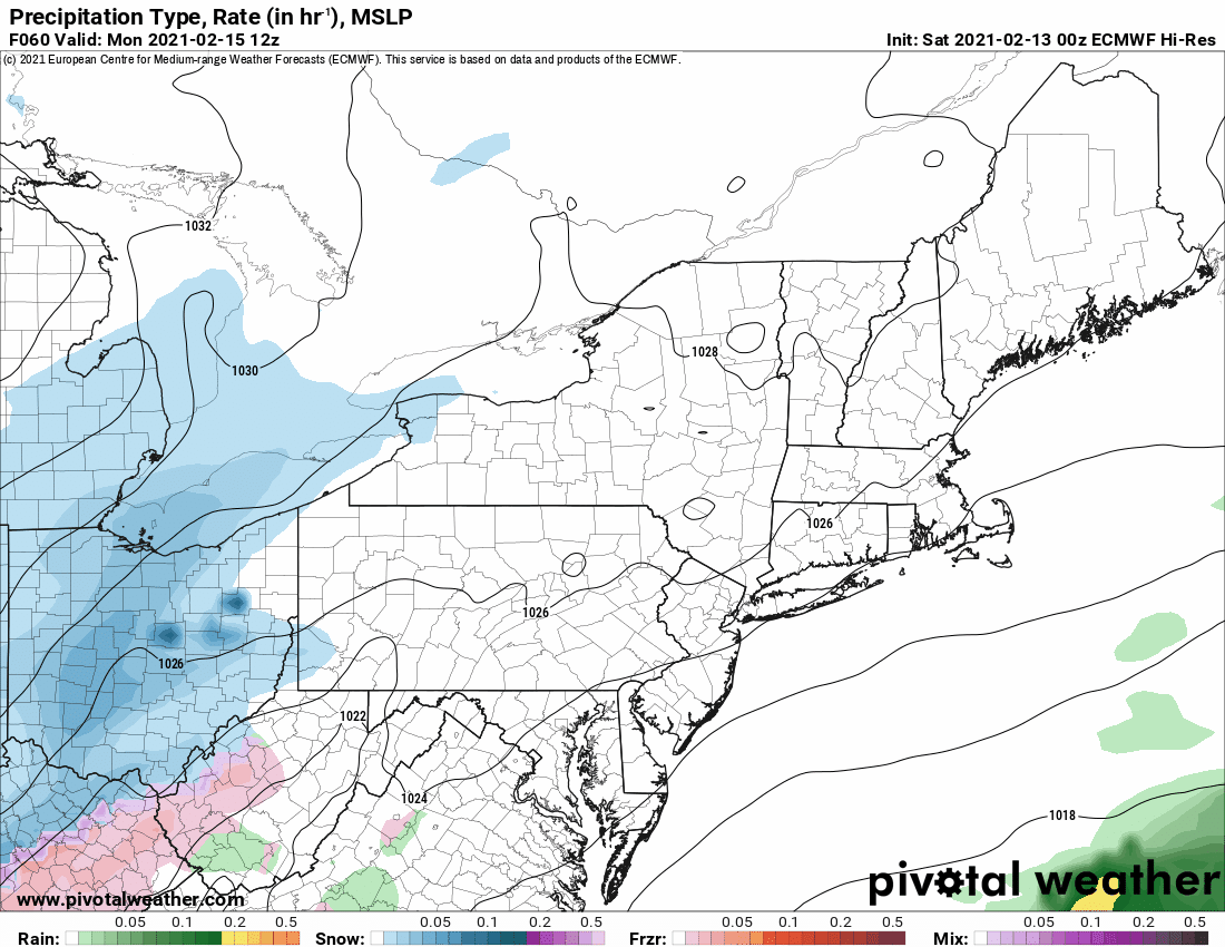
#2 – This storm develops off the Texas Gulf Coast, rides up the west side of the Appalachians to almost Pittsburgh before jumping to the coast. This means heavy precip but with all that warm moist air in the jet stream express lane, sleet mix is a concern for me. You notice the model gets is close to NY but keeps it mainly in PA. It always seems to go farther N in the end than first predictions. I can’t ignore it. Here’s the bottom line: We are getting a lot of snow. Those areas north of the Thruway that stay all snow have a good shot at double digit totals. It’s along and south of the Thruway that sleet could cut the numbers down. Even if more sleet than I’m thinking, you are still shoveling and snow blowing, and the trails will get a nice addition to the base. It’s not a blowtorch thaw. But it may not be all snow in all places. Snow map and forecast reasoning tomorrow after I see 2 more model runs.
#3 – Thursday into Friday AM: This one still trending to the coast and looking more like and all snow event. Several inches of snow is what it looks like now. Still too early to make specific calls but it has potential for 6″+ for many. Should have specifics on this Wednesday, after the Tuesday storm.
#4 – Clipper system next weekend. A few inches plus some lake effect possible.
It’s getting busy. Speaking of busy, the trails will be this weekend! Ride safe, ride right, SLOW DOWN and remember families and many “sweethearts” will be together on the trail. Don’t be the jerk who ruins their day (or life) by being a hotdog or doing things you should not be on the snowmobile trails. That’s my PSA for today.
Be good!
Rich


