
The next storm of this early winter season is coming our way starting tomorrow as colder air comes racing on in with windy conditions and falling temperatures. Expect rain to change to snow during the day Sunday, especially in the morning from the higher elevations to the lower elevations. By Sunday Afternoon, figure snow everywhere. Monday should be a snowy day with several inches of snow, especially northern and western facing slopes of the Adirondacks. Tug Hill will see some but not as much. This end during the day Tuesday.
That’s the short version of what is happening over the next 3 to 3 1/2 days here in Upstate NY. Here are more of the details associated with this forecast in the coming days:

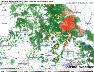
This afternoon and especially this evening, the rain showers and milder air blow on through Upstate NY. With enough cold pockets leftover across the Adirondacks, some freezing rain is expected, and Winter Weather Advisories are in effect for those areas through tonight. The rains should last until the overnight and add up to about 1/2 inch, give or take.
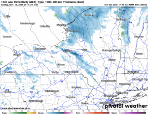
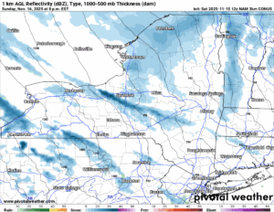
The worm turns Sunday morning! The temperatures will fall during the day, rain will change to snow in the higher elevations first, then in the lower elevations, but everyone will see it change to snow. And it will be an accumulating snow again for many. Not as much or as many places as the last time. But enough to make a deal out of it!
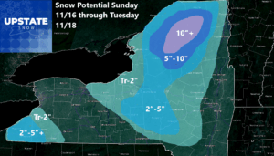
Sunday Night you have three areas of concern across Upstate NY. One is south of Buffalo, particularly the Southern Tier counties of Chautauqua and Cattaraugus Counties. A little bit of Wyoming and Allegheny depending on the exact wind direction. Next is the NW flow off of Lake Ontario hitting the Syracuse area, areas south and west of Utica/Rome. The third area, and most consistent area is the higher elevations north and west facing from Lewis County to Northern Herkimer, St Lawrence, Franklin, N Hamilton, W Essex and W Clinton Counties. In these areas the snows will have a tendency to pile up more!
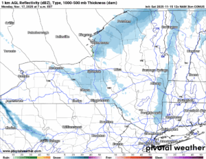
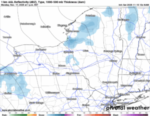
As you see on Monday the snows continue over the same three areas. South and east of Lake Ontario, and particularly on the northern and western facing slopes of the Adirondacks across Northern NY. In this area, I would expect the snowfall to be the heaviest in the state and pile up quickly!
By Monday Night and especially on Tuesday, most of the accumulations with this snow event will be concluded. There is a chance some additional snows could happen but I feel we would be out of the best window by that point.
Once again the accumulation map with some across areas south of Buffalo, but not an all out blizzard. Some to the south and east of Lake Ontario. Inches? Yes. But not feet. This should be manageable, especially after Round 1 we just went through. For Northern NY, particularly north and west facing slopes of the Adirondacks, WATCH OUT! You are the BULLSEYE for this one! We shall see whom gets the most snow out of this one!
If you would like to advertise on the site, reach out anytime!
VENMO: @Zman291
CASH APP: #ZACKLUPIA
Zack and Rich Lupia
Upstate Snow
November 14, 2025
Please thank our advertisers on Upstate Snow!
Business Sponsorship
Ohio Ridge Riders
Enjem’s Flooring America
ilsnow.com
Saratoga Snowmobile Association
Southern Tug Hill Snow-Riders
Business Member
John Schoff Polaris Memorial Ride
Personal Member
Eric Vilovchik
Charles A. Klesse Sr.


