
The following is the winter weather outlook for 2026-27. This outlook will be brief as there are two things battling for control of winter weather across North America, and in particular, the Northeast and Upstate NY. This article is updated as of Friday Morning November 6, 2026.
SUPER EL NINO!
You know it. You love it. Get used to it! It took several months to get here. It will take several months to leave at the least. As of today. the super EL NINO statistics are about as bad as they could EVER be. Even worse than 1877. That El Nino did serious damage and killed a lot of people. It is now 2026 and we have changed so much since then. How much can we truly take on? How much cam we really survive? We have survived several winters from 1990 to today with several El Nino events. The greatest events were 1997-98 and 2015-16. These reached 2.5 C above normal. How much is this Super El Nino supposed to give us?

4 C above normal!

Where do you start? There is nowhere you can turn because nothing that bad has happened in our history. Period.
THE SOUTHWEST HAS BEEN CLOBBERED ALREADY!
Don’t look at the forecast for the next 7 days. Look at the actual weather in the second half of October. DEVESTATING. Severe Thunderstorms. Tornadoes. Flash Flooding. High Winds. High Elevation Snows. This part of the country in the last half of October has really been hit harder than anywhere else. Thank God for the break! For now…
https://www.npr.org/2026/10/28/nx-s1-6009547/el-nino-forecast-us-winter
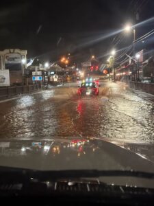
You can look more recently at what has been happening just in Georgia and Tennessee. It was in a small area, but in the mountains, they got a 1,000 year flood event which did major damage to several towns!
And then there is the polar vortex! And it is not good:
https://www.scientificamerican.com/article/the-polar-vortex-is-about-to-go-haywire/
WE HAVE BEEN VERY DRY HERE FOR MOST OF THE EAST COAST!
Look around Upstate NY. You see how dry it has been this summer and particularly this fall. Rainfall is literally 1/2 to 2/3 of what it should be right now. And guess what? Between now and the week of Thanksgiving, there some days of rain in the forecast but not as much as there should be. Upstate NY always gets precipitation in November. But you look at the longer range, especially to our west, and it almost goes DRY!
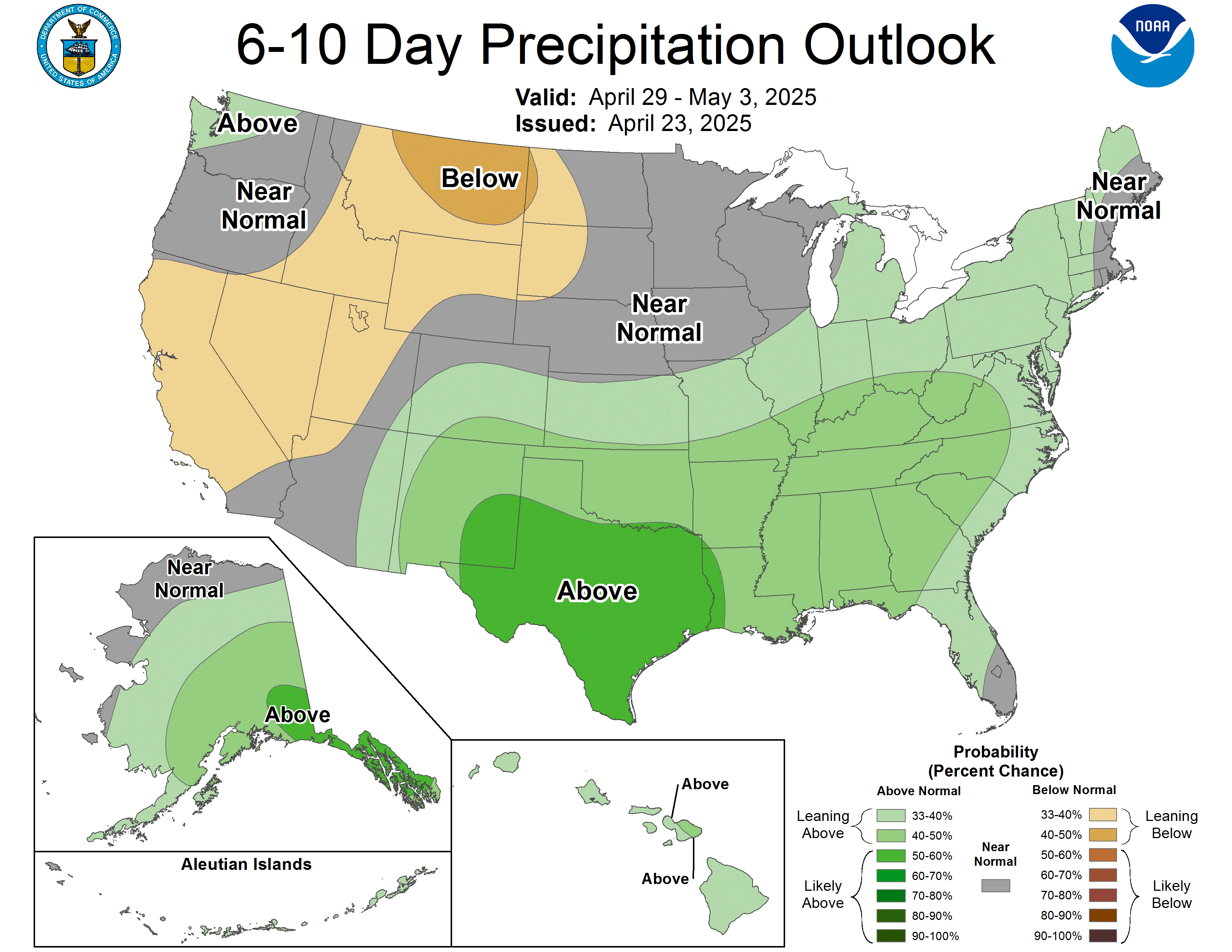
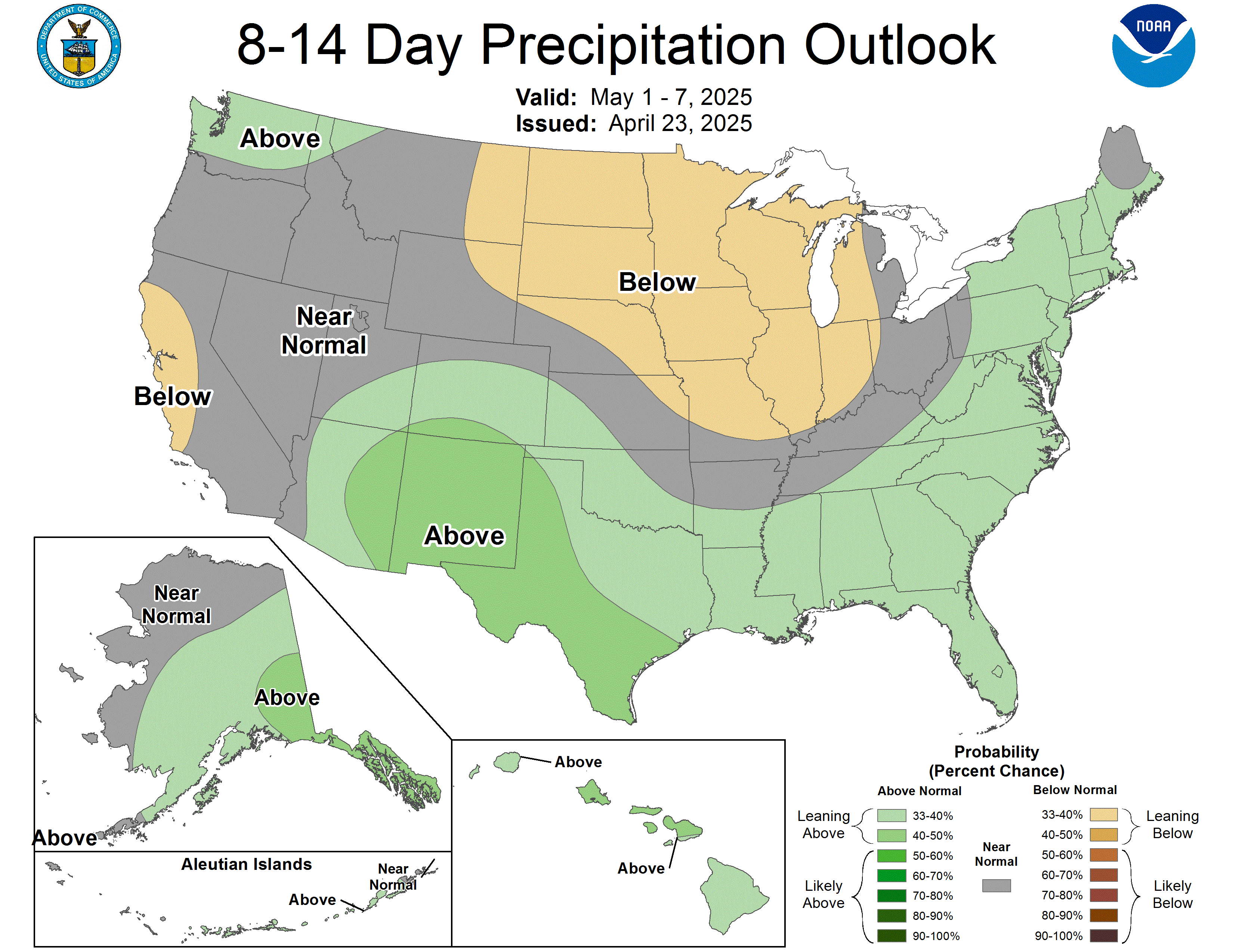
Despite the forecasts for rain this weekend and into early next week across Upstate NY, PLEASE KEEP IN MIND THIS LONGER RANGE FORECAST is going to be leading the forecast DRIER than normal. Which could mean some sunshine. Which is rare by November standards around here.
WHAT HAPPENS THANKSGIVING AND BEYOND?
The week 3-4 outlook comes out later today. This is the best indicator we have to look for heading through Thanksgiving and into early December. Either one of two things will happen:
- It turns suddenly COLD AND STORMY here in the Central and Eastern US with several winter storms from Thanksgiving, through the Holiday Season, and into the first of next year before any major changes. Or:
- It stays WARM. Like nothing has even happened. The SSW (Sudden Stratospheric Warming) goes to another part of the nation or the world and hammers them! It leaves us with sunshine and warmth similar to December of 2015. Looking forward to more 60+ even 70+ December afternoons in the Eastern half of the US? Get ready! It could be getting ready to happen all over again.
I hate to put the start of winter so bluntly, however, we are dealing with the extremes of Mother Nature. Therefore, she will deal with us in these extremes. Somehow. Someway.
THE REST OF THE WINTER?
WHO KNOWS?! In all seriousness, with the strength of the storms out there, the incredible dynamics of what we will be seeing and nothing to compare this to, it will be near IMPOSSIBLE to give you guys any sort of a great means for a forecast. Last year we were leaning heavily above normal. Because we were due. November though January was Top 10 then it shut down after that. Still we got the most snow we had seen in a season in 20 years!
THE BOTTOM LINE
Forecast: Snowfall for the 2026-27 Season is NORMAL (within 20% of normal). 50% chance of that. 25% below. 25% above. Why? It could go 2015-16 and we get screwed. It could go 1997-98 and we get POUNDED. Or we end up getting pounded part of the winter and then it’s over. Before it’s over. WHO KNOWS?! This is honestly my best guess. For now.
The final WINTER WEATHER OUTLOOK for 2026-27 releases DECEMBER 1, 2026 here. Be watching!
Zack and Rich Lupia
Upstate Snow
November 6, 2026
PLEASE THANK OUR SPONSORS FOR THE 2026-27 SEASON!
Business Sponsors
Enjem’s Flooring America
Ohio Ridge Riders
ILSNOW.COM
Business Member
John Schoff Memorial Vintage Ride – January 9, 2027
Personal Member
Charles A. Klesse Sr.